What do the different cyclone classifications mean?
October 30, 2023
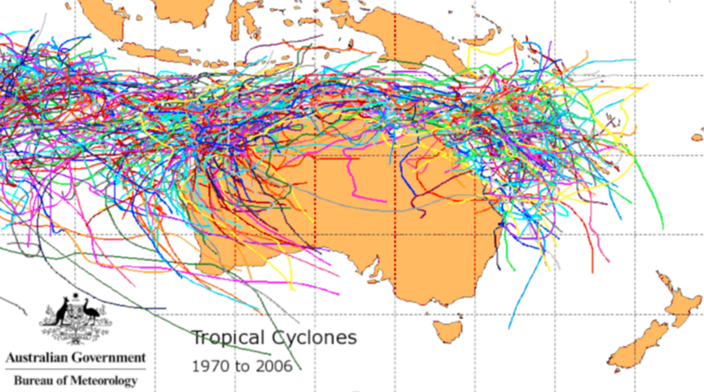
Each year Australia faces the threat of tropical cyclones. They vary in severity and location and the amount of damage they can cause. You might think that just living in North Queensland means you are at risk, but that’s not the case. See the below map from the Bureau of Meteorology that shows cyclone Activity from 1970 to 2006… their effects over a lot of Australia.
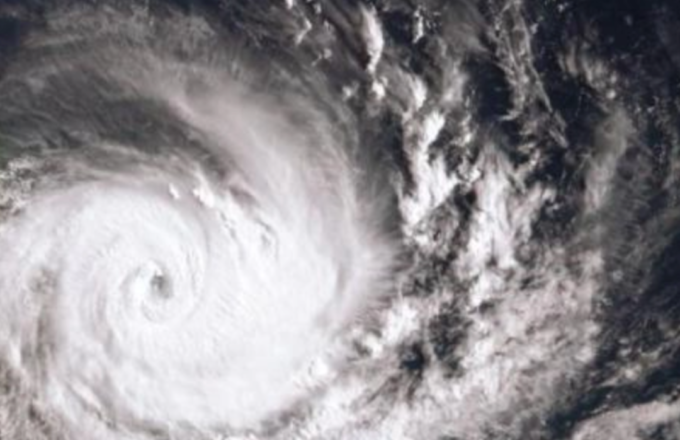
Cyclones are powerful weather systems that can cause significant damage to the built and natural environments. They develop from low-pressure systems that develop over warm oceans in the tropics, and generally intensify over several days, generating severe winds, strong rain, and flooding. Cyclones produce very strong and potentially destructive winds that rotate clockwise around a calm centre (the ‘eye’).
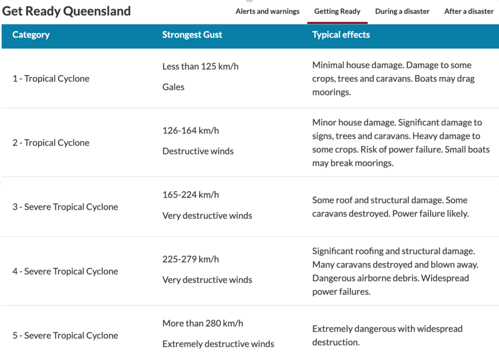
According to the Bureau of Meteorology (BOM) the severity of a tropical cyclone is ranked in categories from 1 (weakest) to 5 (strongest). The category given to a cyclone: is based on its maximum mean wind speed. doesn’t indicate the severity of other hazards the cyclone may bring.
To be classified as a tropical cyclone, there must be one-minute-average maximum sustained winds 10 m above the ground of at least km/h to be a Category 1). The highest classification on the scale, Category 5, consists of storms with sustained winds of at least 280 km/h.
As a cyclone approaches, the wind and rain gradually increase over several hours. Winds caused by cyclones are powerful enough to break large trees, roll over sea containers, and blow away unsecured caravans, garden sheds, and poorly constructed roofed patios. Strong winds associated with cyclones can cause extensive property damage and turn loose items into wind-borne debris that causes further building damage. Slow-moving cyclones can take many hours to move past a particular location, causing extreme wind and rain that can last up to 12 hours. BOM has a 7-day forecast map on its website to show the potential risk of one in your area. This is a great resource to use when there is a threat of a cyclone.

Risk of storm surge
When a cyclone is approaching there is also a high risk of a storm surge, but what is a storm surge?
A storm surge is a rise above the normal water level along a shore resulting from strong onshore winds and/or reduced atmospheric pressure. Storm surges accompany a tropical cyclone as it comes ashore. They may also be formed by intense low-pressure systems in non-tropical areas.
The combination of storm surge and normal (astronomical) tide is known as a storm tide. The worst impacts occur when the storm surge arrives on top of a high tide. When this happens, the storm tide can reach areas that might otherwise have been safe.

Understand your risk
Queensland homes within 50 km of the coastline north of Bundaberg need to be strong enough to withstand cyclonic winds. In addition, homes located within 100 to 200 metres of an open shoreline are at risk of impacts from breaking waves caused by the storm tide.
Impact on your insurance
Living in a cyclone-prone area can also impact your insurance. Although the recent Reinsurance Pool initiative has commenced, we are yet to see a reduction in premium flow onto clients. As the Pool matures in the next few years, we hope to see some relief however in the meantime, in areas where the risk of a claim occurring is higher, then the likelihood of losses is higher too, and in turn the premiums the insurer needs to charge will be higher too.
Talk to one of our local insurance brokers to get advice on what type of policy & coverage you might need.
Download our Free Cyclone guide to help minimise the risk of damage and help you prepare before the Cyclone season hits. We’ve got one version for your home and one for your business. Click on the images to download